Castletown Harbour near Dunnet Beach
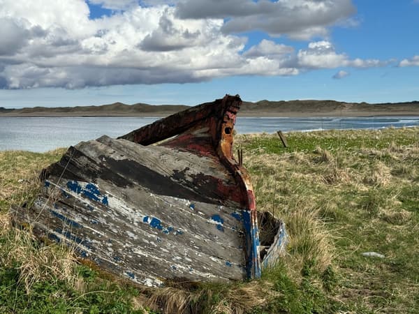
Castletown Harbour near Dunnet Beach
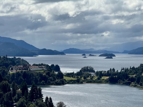
One of my favourite places in the world. Remote and beautiful.
Whilst in El Chalten and Bariloche I knew we wanted to do hikes. Over the 4 days of hiking, I used a combination of apps to help us enjoy our hikes. I’ve listed the 3 below and described what I liked about each of them.
My requirements were:
My requirements didn’t include navigation or recording since my Garmin Instinct series 2 would cover this.
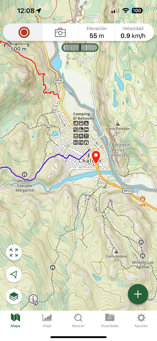
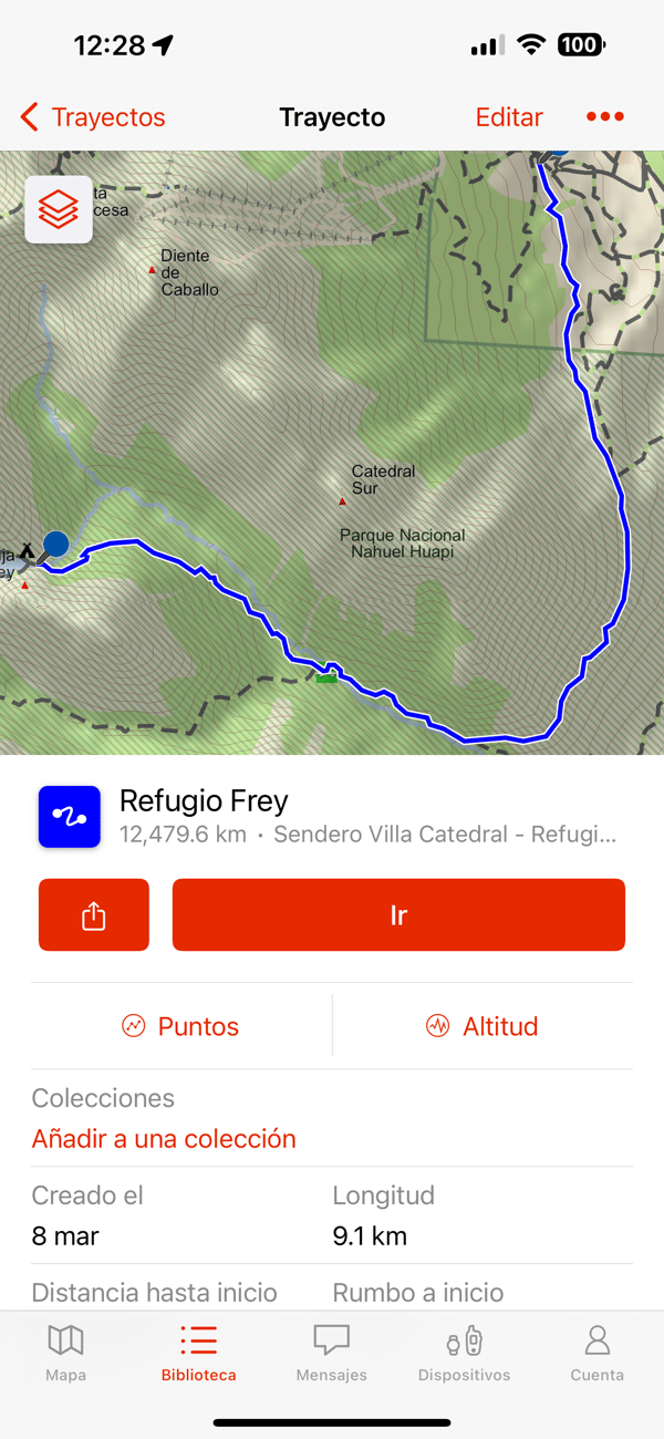
Gaia has the prettiest maps out of the three apps I tried. I downloaded maps for El Chalten, El Calafate, and Bariloche. Whilst the UI for downloading was clunky, it worked. Gaia offered an iPadOS version and a web version for its maps.
I found Gaia easy to use and reliable during hikes. It was easy to figure out which turns to take, and how much of our hike was left.
I ended up paying £51.90 for 12 months of access to their mapping.
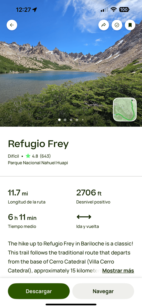
Whilst Gaia had beautiful maps, All Trails helped us decide where we wanted to go. They have lots of trail reviews and pictures.
Unfortunately, All Trails doesn’t offer an iPadOS version and for that reason chose Gaia GPS over All Trails for downloading maps.
All Trails is an App Store Award-winning app, winner of the iPhone App of the Year. I can see why, the app has a great UX.
I wish I had discovered this app before our vacation. The maps themselves don’t look as good as either All Trails or Gaia, but the necessary detail is there. And it’s free.
Its killer feature is the tight integration with my Garmin Instinct. During an active hike activity on the watch, I could open Garmin Explore, find a destination on a trail, Garmin Explore would create the course, sync it to the watch and start navigating. Seamlessly. Then I could see ETA, estimated time remaining, and ascent remaining on my watch without having to take my phone out of my pocket. It worked great.
Garmin Explore has an iOS and iPadOS version. It’s available on the web via explore.garmin.com The maps are downloadable by region, so it’s easy to download everything you need before hitting the trails.
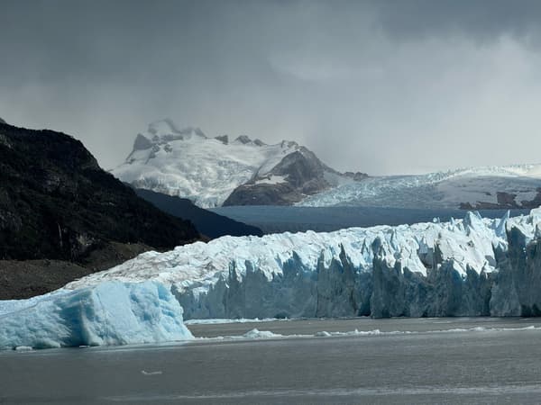
Circuito Chico is a ~20km road that is ~20km from downtown Bariloche. It is one of the main attractions in the area and offers spectacular scenery and it’s from there that you can access Colonia Suiza. A picturesque Swiss-style village. Cycling the Circuito Chico is often suggested as the best way to experience it as opposed to driving. My wife and I recently visited Bariloche and completed the Circuito Chico on bikes but it ended up being a day of frustration rather than one of relaxing in a gorgeous location.
Don’t cycle from Bariloche to Circuito Chico! It’s a ~40km round trip from downtown Bariloche and is not worth the time and effort. You might think, like I did, what could ruin a 40km ride near the banks of the nearby lake?
It took us almost 2hrs to cycle 20km to Circuito Chic and by then we felt like we’d had enough. The stiff headwind didn’t help either
My advice would be to drive or grab a public bus to Circuit Chico. Then hire an e-bike at the start point. Circuito Chico is not flat! It has numerous short climbs with some tough gradients. Yes, we had a tailwind on the way back but by then we were too spent to enjoy it.
Check my ride on Strava
TLDR: Bring dollars!
I knew the Argentina would present some unique problem when visiting due to the country’s financial problems. Inflation was over 200% and the peso was artificially pegged the dollar. Ahead the trip we bought $1000, a bit more than what we needed. I figured any currency leftover can be used for future trips to countries were the dollar is in demand.
On arrival we found using ATMs to be problematic in Argentina. The maximum withdrawl amount was capped at $15000 ARS and the charge to withdraw was over $8000 ARS. At the time $15000 was the equivalent of around 15 GBP. Not great.
Almost everywhere accepted contactless payment. I either used Apple Pay or Monzo card to pay for things. For everything else we used ARS, and dollars when we were short of ARS. Tipping is expected in the restaurants when service isn’t items on the bill/check/cuenta. The $1000 notes came in handy there.
In Buenos Aires there were plenty of people offering ”cambio”, but as a foreigner this didn’t feel like the safest option. The additional risk didn’t feel like it was worth the offer of a better exchange rate. Instead we used official cambios that offered us a "turista” rate that was marginally better than what the local were offered.
In hindsight I think we got things right. I’d recommend bringing dollars, and find a cambio to buy pesos when you have the opportunity.